To continue this free service to you, we include affiliate links, which means we may receive a commission from purchases made through links. Commissions received from linked purchases will help fund ongoing costs.
HONOLULU (KHON2) — Calvin is currently a tropical storm with sustained winds of 45 mph moving west at 21 mph. Calvin is about 520 miles east of Hilo.
At around 4:30 p.m., the National Weather Service issued a tropical storm warning for Hawaii Island. The areas affected include Kailua-Kona, Captain Cook and Milolii.
Despite the presence of wind shear and drier air, it is expected to weaken very slowly over the next 48 hours. It should arrive just south of the Big Island early Wednesday when 40 mph sustained winds are expected around the center of Calvin.
Expected impacts for the smaller islands:
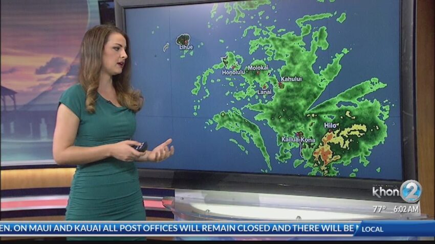
- Moderate rain on the windward side of all smaller islands. Minor flooding is possible for Maui County
- Moderate surf heights may reach advisory level Tuesday night through Wednesday for east facing shores.
Another key aspect of the forecasting scenario is that the Hurricane Hunters have started their reconnaissance missions into Calvin. The first flight was at 7 a.m. Monday morning. Hurricane Hunter reconnaissance missions are only flown if a tropical cyclone poses a threat to populated areas. They are crucial to providing key real-time weather data to improve weather models and forecasts.
The exact track is critical in determining specific impacts. The expected impacts listed above are based on the forecast track. With that track, the winds from Calvin would mostly be coming from the northeast to east which means the mountains would be another lifting mechanism for the storm, possibly increasing rain totals for windward areas, mostly for the Big Island and Maui.
Source : https://www.khon2.com/hawaii-hurricane/tropical-storm-calvin-continues-quick-westward-direction-to-hawaii/